image registration
Data-driven registration of satellite data
The immense availability of earth observation data has enabled the remote sensing community to make great progress on a variety of applications. More often than not, these applications require that the employed images are on the same coordinate system, making the registration process a necessary prerequisite.
Selected related publications
- In Vakalopoulou et al. 2021 we present a comprehensive survey of recent advances in image matching and registration.

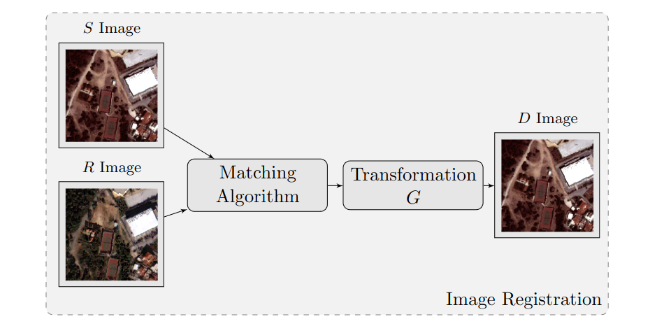
A schematic diagram of the image matching and registration presented in Deep Learning for the Earth Sciences [Vakalopoulou et al. 2021]
- In Papadomanolaki et al. 2021 we present an end-to-end multistep approach for learning an accurate mapping between unregistered image pairs of satellite data.

Results of the method presented on the MDPI 2021 [Papadomanolaki et al. 2021]
References
2021
- Unsupervised multistep deformable registration of remote sensing imagery based on deep learningRemote Sensing, 2021
- Deep learning for image matching and Co-registrationDeep Learning for the Earth Sciences: A Comprehensive Approach to Remote Sensing, Climate Science, and Geosciences, 2021